


Le Rozier

gmarboeuf
User

Length
7.1 km

Max alt
811 m

Uphill gradient
579 m
Km-Effort
14.9 km

Min alt
481 m

Downhill gradient
596 m
Boucle
Yes
Creation date :
2015-04-20 00:00:00.0
Updated on :
2015-04-20 00:00:00.0
3h29
Difficulty : Medium

FREE GPS app for hiking
 SityTrail
IGN / Geographical institutes
SityTrail Plus
The world is yours!
About
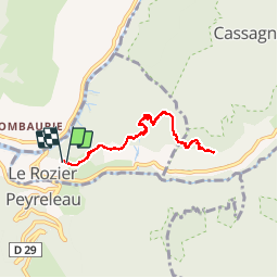
Trail Walking of 7.1 km to be discovered at Occitania, Lozère, Le Rozier. This trail is proposed by gmarboeuf.
Positioning
Country:
France
Region :
Occitania
Department/Province :
Lozère
Municipality :
Le Rozier
Location:
Unknown
Start:(Dec)
Start:(UTM)
516913 ; 4893256 (31T) N.
Comments